Falkland Islands Map
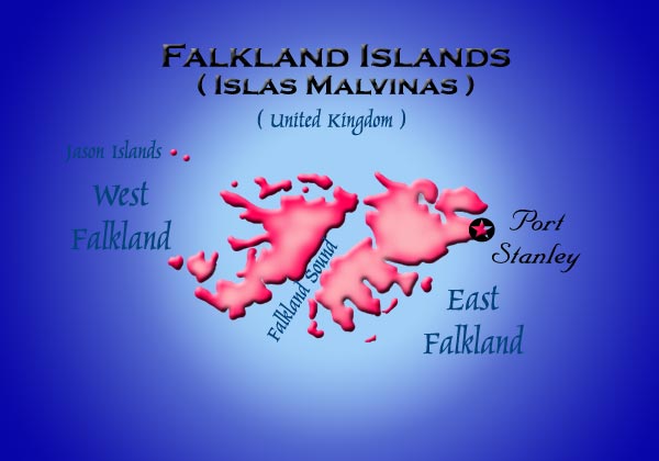
The controversial Falkland Islands lie 300 miles east of Argentine Patagonia. Two major islands, and many smaller ones make up the Falklands. The area is roughly equivalent to the size of the U. S. state of Connecticut. The climate in the islands is moderate, with summer temperatures sometimes reaching 75º F. Subfreezing temperatures are unusual, and the rainfall totals only 24 inches a year.
The Islands were unpopulated when the European sailors came into this in the 17th century. The French navigators of St. Malo gave them their Spanish name, Isla Malvinas. Beginning in the mid 1700s, the Falklands have been the source of many battles between countries fighting for control. They continued to languish until the mid 19th century when the wool business suddenly became lucrative. The struggle for control of the Islands by Argentina ended with the 1982 war with Britain.
The capital, Stanley was founded in 1845. It is located on East Falkland Island, and is where two-thirds of the 2500 people live. Nearly everyone else who lives in camp, which is a term for all the Falklands outside Stanley, is involved in sheep ranching. Stanley is the service center for the wool industry and a significant port for Asian and European fishing fleets. Their major source of income is selling fishing licenses for the rich fishing grounds surrounding the islands.
This animated flag was provided through the courtesy of
Multimedia Palace.
Click any image above to go to the next page.
|